Lower Dean
#2261
Search:
Google images eBay wikipedia YouTube
NGR:
TL041698

(
52.31606,
-0.4742)
Map/aerial photo of the area around the mill
composite mill
function:Corn mill
- collapsed 1959, and roundhouse reduced to 1 storey around 1969, now ruinous
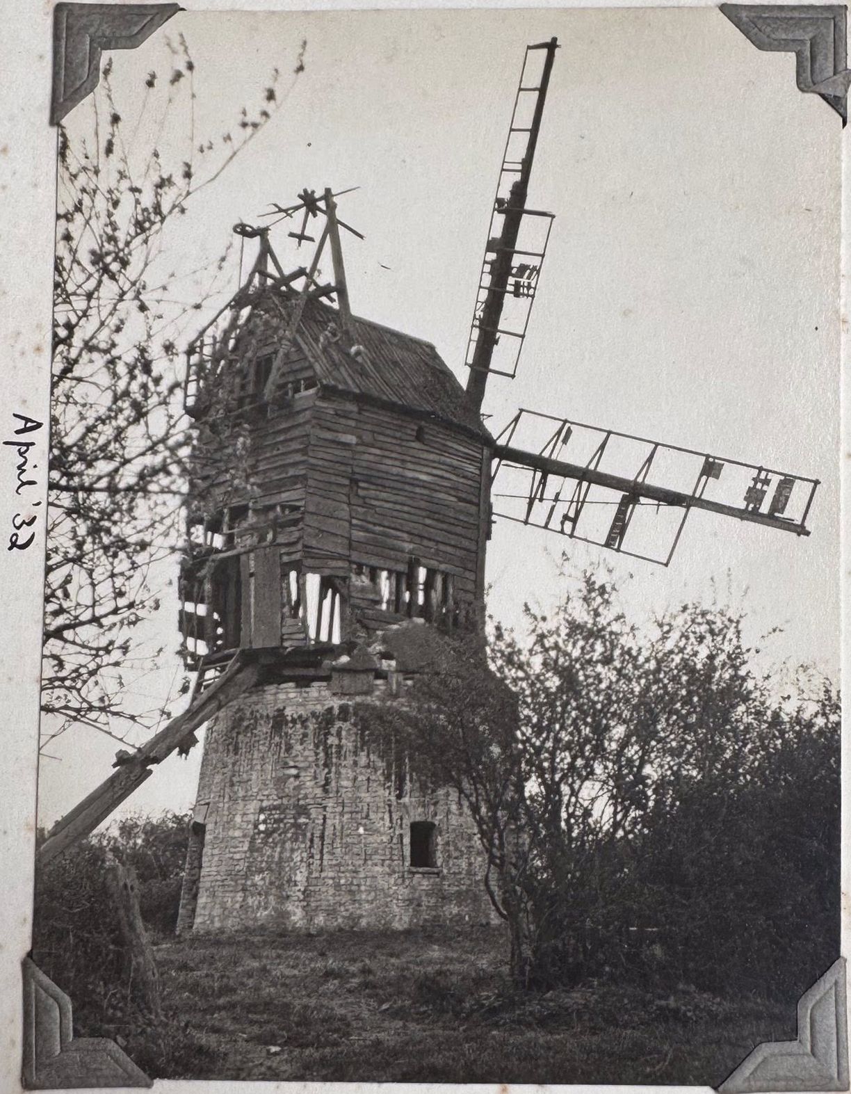
Dean Mill, Lower Dean, Bedfordshire, April 32
From a collection owned by Jan Smith
[
info]
Entry in Mills Archive database -
#2261 - Dean Mill, Lower Dean
(has photos)

Ceased working in 1918.
Muggeridge Collection photos
- 537300 - Hargrave, Lower Dean, Side, Beds.

- 537301 - Hargrave, Lower Dean, Side-3/4 Rear, Beds

- 537302 - Hargrave, Lower Dean, Side, Beds.

- 537303 - Hargrave, Lower Dean, 3/4 Rear, Beds.

- 537304 - Hargrave, Lower Dean, 3/4 Rear, Beds.

- F183589 - Hargrave. Beds. (Lower Dean) 5 Aug 1958
 (colour slide)
- F183590 - Hargrave. Beds. 5 Aug 1958
 (colour slide)
- F183591 - Hargrave. Beds. (Lower Dean) 5 Aug 1958
 (colour slide)
composite millPhotos: (1) Howes (a) w/o, c1905 (2) NMR (a-d) derelict with 4 sails (e-f) surviving roundhouse (g) interior of roundhouse with post, quarterbars and sheers (h-i) exterior view of roundhouse with some wreckage of mill body (j-n) wreckage of mill (o) ruined roundhouse with some wreckage on top, wrongly filed under Littledean, Glos (p) view inside ruined roundhouse looking up at wreckage on top, wrongly filed under Littledean, Glos (3) A C Smith (WIB) (a) surviving roundhouse, May 1971 (4) NMR (WC) (a-b) derelict with 4 sails (5) Elliott (a-b) derelict with 4 sails, 1936 (6) MOTHOS (UC) (not captioned) (a-b) w/o (7) UOK (MC) (a) derelict with 4 sails, August 1933 (b-c) derelict with 4 sails, July 1935 (d-e) derelict with 4 sails, September 1946
