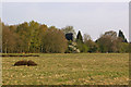
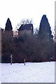
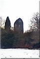
Tadworth
#2600
Search:
Google images eBay wikipedia YouTube
NGR:
TQ236554

(
51.28430,
-0.2286)
Map/aerial photo of the area around the mill
post mill
function:Corn mill
")
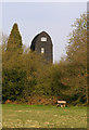
Tadworth - (Photo - Richard Evans), 9th Feb 2002
[
info]
[
info - photo is of Outwood]
[
photo]
Entry in Mills Archive database -
#2600 - Walton Mill (2), Banstead
Muggeridge Collection photos
(5) Geograph images are licenced under a Creative Commons Attribution-Share Alike licence
Flickr images are copyright their individual photographers.
Images from Historic England - hover over image to see copyright info, and to enable zoom
Dorking Road, Banstead, Reigate And Banstead, Surrey, KT20 6AQ
30 Jun 2001 - Photograph (Digital)


