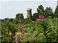
Worstead
#2158
Search:
Google images eBay wikipedia YouTube

(
52.79733,
1.42564)
Map/aerial photo of the area around the mill
Tower mill function:Corn mill
Entry in Mills Archive database -
#2158 - Briggate Windmill, Worstead
(has photos)

Geograph images are licenced under a Creative Commons Attribution-Share Alike licence
Images from Historic England - hover over image to see copyright info, and to enable zoom
Windmill Road, Worstead, North Norfolk, Norfolk
26 Mar 2002 - Photograph (Digital)

