Haddiscoe windmill, Norfolk


Haddiscoe #2239

NGR: TG459016
(52.55606,1.62730) OS map + aerial, Google Maps Aerial - Dual Google & Bing Maps


Map/Aerial photo of the area around the mill

Pettingell's Mill: tower mill (drainage)

Entry in Mills Archive - #2239 (login required)

Entries in photo archives:

Pettingell's Drainage Mill [2008-05-04]

Pierre Terre

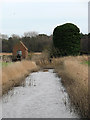
Near Pettingell's Mill [2008-05-04]

Pierre Terre

Pump house beside remains of Pettingell's Mill [2008-01-24]

Evelyn Simak

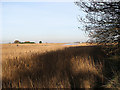
View towards Seven Mile House [2008-01-22]

Evelyn Simak

Geograph images are licenced under a Creative Commons Attribution-Share Alike licence
[Search Muggeridge Collection]


[Windmills] [Watermills] [Bookshop] [News] [Site map] :

Last updated 27/05/2011 Text and images © Mark Berry, 1997-2011 -