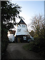
Weston Colville
#2409
Search:
Google images eBay wikipedia YouTube
NGR:
TL619530

(
52.15127,
0.36584)
Map/aerial photo of the area around the mill
smock mill
function:Corn mill
- converted

Weston Colville,
, 17/8/80
© Trevor Stainwright collection
Entry in Mills Archive database -
#2409 - Smock mill, Weston Colville
Muggeridge Collection photos
(1) Geograph images are licenced under a Creative Commons Attribution-Share Alike licence
smock millPhotos: (1) NMR (a-e) derelict with cap
Flickr images are copyright their individual photographers.
|
International Mill Database Entry |
|---|
| name |
Weston Colville Windmill |
| id |
59661 |
| description |
House converted smock mill |
| drive power recent |
none |
| drive power originally |
windmill |
| mill type |
smock mill |
| function type |
grain mill |
| condition type |
no technique |
| use today |
private residence |
| map location |
52.15126,0.36591 |
| country |
United Kingdom |
| state |
England |
| county |
Cambridgeshire |
| municipality |
Cambridge |
| city |
Weston Colville |
| street |
Mill Hill |
| logo detail |
windmill_nophoto |