(1) Geograph images are licenced under a Creative Commons Attribution-Share Alike licence
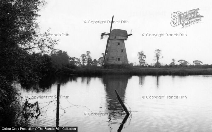
South Ockendon,
the Windmill c1960 Reproduced courtesy of The Francis Frith Collection
Essex Countryside references
May 72:
p64
Readers Forum: Letter on "Sad fate of smock mills" by Alan Cordell, with details of the state of various smock mills,
including Upminster, Terling, Orsett, South Ockenden, and Great Holland. Photos of Terling and Orsett.
July 85:
p14
"Worth Reading - Industry in agriculture", review by John H Boyes of the 4th volume in the series
"Essex Windmills, Millers and Millwrights" by Kenneth G Farries. Includes a photo
of South Ockendon smock mill, before its collapse.


 (
(
