
Search: Google images eBay wikipedia YouTube
Werrington:
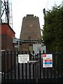
tower mill
function:Coal mill|Corn mill
-
Entry in Mills Archive database - #1275 - Werrington Mill, Caverswall
| Last generated 30/06/2026 | Text and images © Mark Berry, 1997-2026 - |
 (
(
